I have been tracing the original Roman London wall around the city of London, and some parts of this are very easy to find, particularly near to the Tower of London, and the short stretch of the wall from here northwards towards Fenchurch street station. I also use maps old and new to explore what parts of London were along this now largely invisible wall, and where it is worth stopping along the way for a few minutes respite in a busy London town (well it will be busy again one day).
Two things are important, I start from Fenchurch street, and travel in from Upminster (both are fully accessible if you plan in advance). Secondly, I suffer from walking great distances, and climbing steps, therefore all my walks are aimed at those lacking the confidence to hike for miles, and at a pace.
Let’s start, Upminster is accessible, I have proof of this, as I spotted a member of staff providing a ramp for a customer in a wheelchair to access the train. This was to my advantage as I would have missed the train! This section of the c2c service travels in via a few stops, including Barking (do not use this station), West Ham, Limehouse (on the DLR) and Fenchurch street is the end of the line.
If as you enter the station on the train watch look southwards, and sections of the the original Roman wall can be seen. They are near to the last carriage on the train, and there is often another train blocking this view, but this is a useful measure in determining where this wall would be on the northern side of the station.
There is only one accessible entrance / exit from Fenchurch street, which is provided with escalators and a lift, whilst the alternative is many flights of stairs. Walk the full length of the train, and exit as appropriate, I used the escalator – I was not quite sure why both escalators were going down.
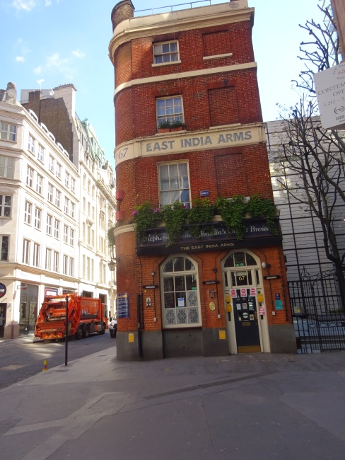
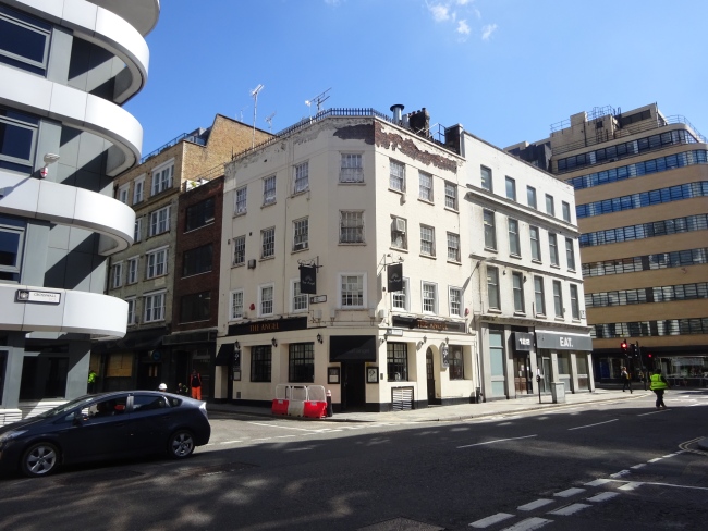
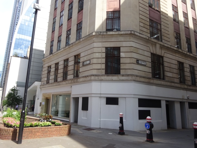
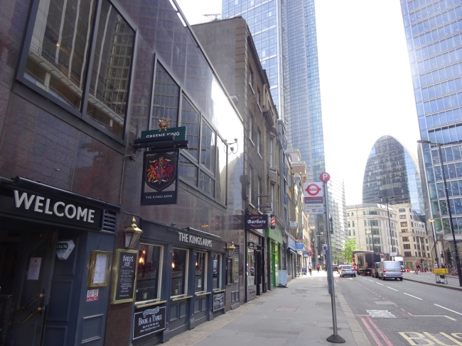
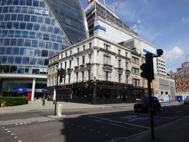
Exit the station, and this is the view :
Turn right, and pass the East India Arms (this started life as the Magpie and Punchbowl by 1784),
and then turn right again into Lloyds avenue, we are imagining that we are walking back along the full length of the train, if you get my meaning. Walk down Lloyds avenue towards the railway bridge, Crosswall and Crutchedfriars.
If you wanted to visit the sections of the wall I am not visiting today, walk under the railway bridge and there is an opening on the right hand side to access the walkway towards the original wall, but not today!
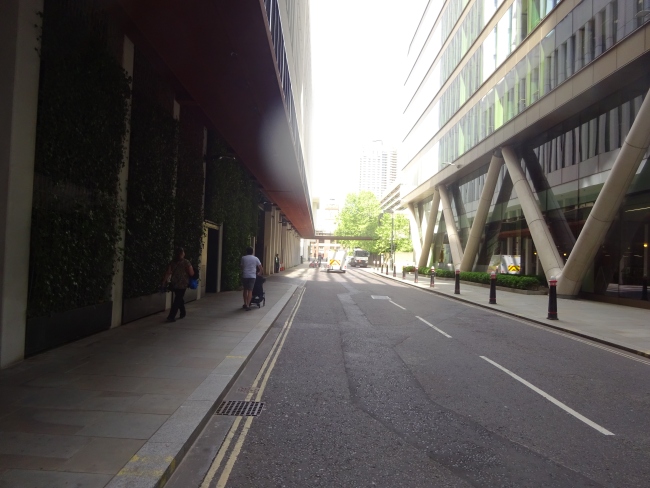
The building to our left in the picture is in Crosswall, and leading to America square, so wander along here; i.e. turn left.
Crosswall, and leading to America square, in June 2021
I should mention here that there is a section of the Roman wall to be seen inside the conference building in the picture. You can just about make it out if you peer in at one of the corners. I do know people who have photographed it when the conference building is quiet.
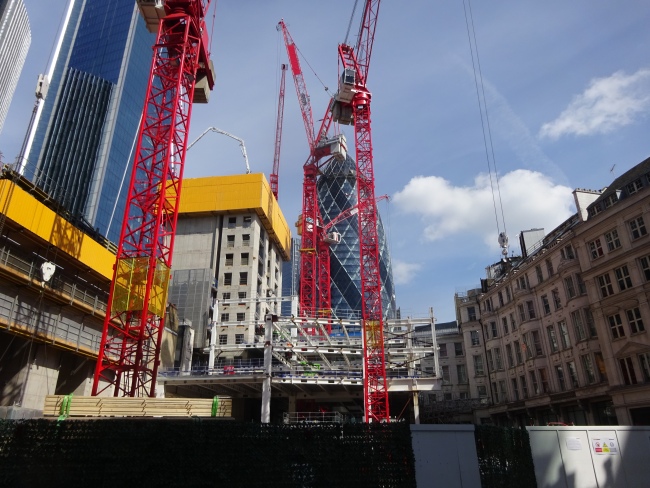
A short walk along, you will currently see lots of workmen hanging around waiting for deliveries to the many building sites across London. The scale of building in London is unparalleled and is generally well organised. We are looking for the Angel which is on the corner of Vine street, which is where we are heading.
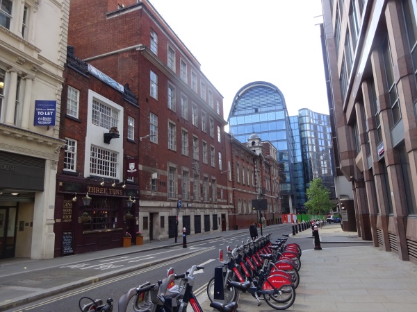
The walk along Vine street is the only way of following the wall at present, although it is actually further to the east of the original wall which is long gone under generations of rebuilding of london, hey ho. When you reach India street, turn left and right again into Minories, and we are now back on track. There are sections of the wall in the John Cass (the famous slaver) college, now named the Dame College. I believe there are also remnants to be seen in the Three Tuns public house.
There is considerable history of the Three Tuns on my pubwiki, but one story I thought interesting was the police case in December, 1857 when a Rev Edward May, head master of the Brewers Company’s school, unlawfully assaulted and beat John Henry Grossmith, one of the schoolboys and son of Mr Grossmith, of the Three Tuns Inn, Jewry street.
Clearly, not much became of this case. In June 1858, John Francis Grossmith, licensed victualler, of the Three Tuns, appeared in discharge of his recognisances on a charge of having violently assaulted the Rev Edward J May, head master.
Now turn round and face Aldgate. There is a lot to be seen, and you now need to use your imagination a lot.
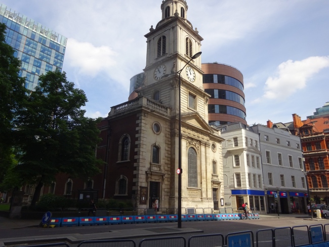
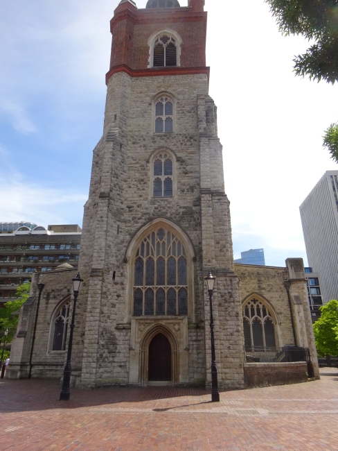
Firstly, opposite, on the other side of Aldgate is the church of St Botolphs without. And it is dwarfed by the buildings of the city in the background.
Also, there is a Boots store behind you which reports on a plaque, that the Aldgate, the Roman gate in the Roman wall was here, and the pelican crossing could be transformed into a huge brick extravaganza. Just imagine it.
The actual Roman wall continues from here in a north-westerly direction along Dukes place (formerly called Duke street), but first we need to cross Aldgate square to reach it. You can get a 100 bus from here if you don’t feel like walking the wall to the london museum.
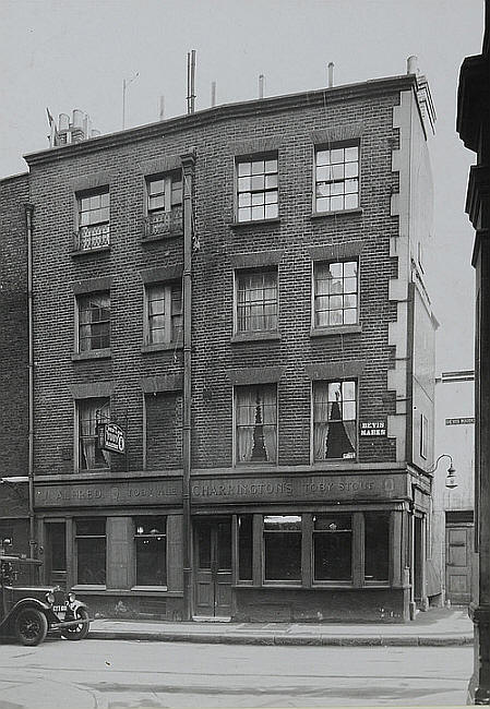
I seem to have forgotten to take any photographs at this stage, next time I will get some. Dukes place leads into Bevis Marks, and there was once a pub called the Red Lion at 17 Bevis Marks, Latterly it was called the White Horse. The address of 24 Bevis Marks was Beech House, and is still the same, and 17 Bevis Marks is at the junction with Creechurch lane on the northern side. It has been rebuilt to some extent, and it is probably now this building which still has an address of 17 Bevis Marks.
This is 17 Bevis Marks, at the junction with Creechurch lane in June 2021
There are lots of sitings of bits of the London wall through archaelogical digs in the past, but none survive today, the wall ran somewhere along the rear of the current buildings.
The current architecture makes it an interesting walk to take your time on, including a building wall which seems to defy gravity, but then there are some really weird architectures in London which adds to the excitement.
This shows as Satigo on Google maps, here is my picture of Bevis Marks and the corner of Goring street in june 2021:
Bevis Marks and the corner of Goring street in june 2021
Eventually Bevis Marks leads into Camomile street, after St Mary Axe; and these last three streets run parallel with Houndsditch which follows the line of the old ditch outside the wall. It probably existed in Roman times, and has been filled with rubbish, and redug through the ages. Allegedly it was filled with dead dogs, hence the name Houndsditch!
Camomile street brings us to Bishopsgate, where an additional gate was erected in the wall. The next shot is of Bishopsgate and Wormwood street.
Bishopsgate (left) and Wormwood street (right) in June 2021
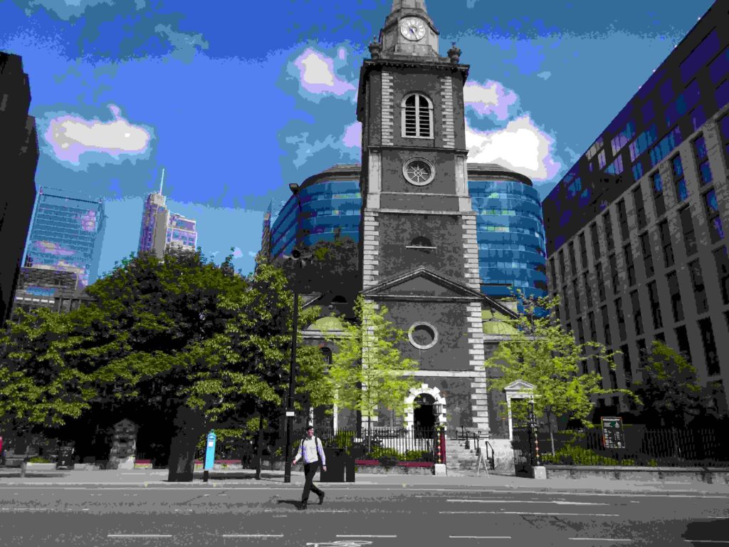
Before we continue our route, I took an interest in St Botolph Bishopsgate church, this is a stones throw from Liverpool street, and its stations. Around this chuch is a walkway, the Aldermans walk, and places to stop and take in a bit of the quiet; and I watched a game of tennis in a small court whilst surrounded by the modern city, and the beauty of an ancient church.
The wall follows Wormwood street, the right section of this picture, and pass the Kings Arms. The Kings Arms, now rebuilt inside a modern office block backs onto the Bishopsgate churchyard, this being its former address.
Anyway, onwards towards the Museum of London tracing the London Roman wall, and we get to the appropriately named ‘London Wall’ which is basically an extension from Wormwood street.
The first noticable building on the right is All Hallows Church perched along the sidewalk and includes part of the original Roman London wall. The city-wall still forms the North boundary of the churchyard and the external face was discovered in 1905, as mentioned in my Londonwiki about the churchyard.
Further along, the buildings are a lot newer, and brighter. They dwell into insignificance, but this is what the London Wall now looks like, looking backwards from All Hallows again:
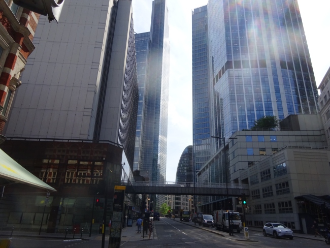
The London Wall in June 2021 – a view from All Hallows church back towards Wormwood street.
A little further along the London Wall is a rather delightful circus, i.e. the Finsbury circus. This was just a quick detour, but there is also a park area to have a rest stop.
Finsbury circus, London Wall in June 2021
And then we arrive near to Moorgate where a number of public houses adorn the walkway, including the Globe.
For a quick insight to this area, highly altered over time. This section of Moorgate was originally called Finsbury pavement, and before this it was called Fore street. Here is Fore street in an 1832 and 1842 street directory listing, to add a bit of fun. The Fore street name is actually still very relevant, as just past Moorgate and the Metro Bank is a turning called Fore street today, and this is the actual line of the original London wall, and the newer London Wall is a diversion from the facts.
We turn right, just slightly after the Metro Bank along Fore street. It is not a very exciting looking street, but it is only a short walk. And lots of more interesting bits are yet to come.
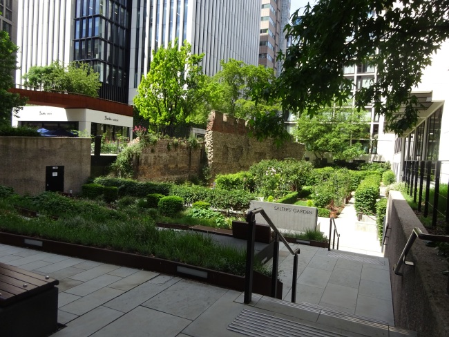
After a very short section of Fore street, we are met on the left with an apparition, the Salters gardens, alongside Salters hall. What a lovely spot to sit and take in the sun and let the world go by. Some of the walling is the original wall again.
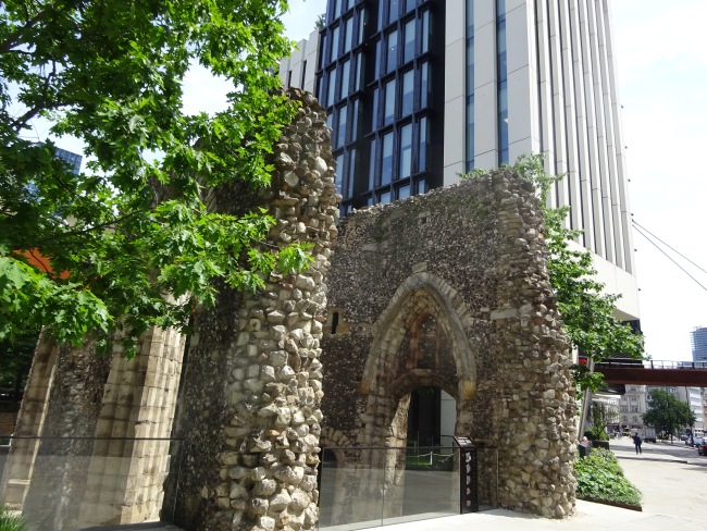
Also at this point, and actually on London Wall is the St Aphage churchyard. There are sections of wall to be seen here, and it is not thought these are part of the original London wall, but nevertheless it is a nice distraction.
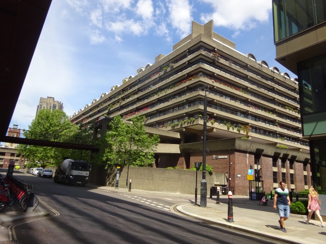
On the opposite side of Fore street is the Barbican building estate, probably the height of opulence in its time of being built, and very nicely situated for the city, but not a place I would want to live.
Following Fore street, the road bends and joins Wood street. Now I got a bit lost about here, and tried to take a broken lift up to the walkway above called St Alphage walkway.
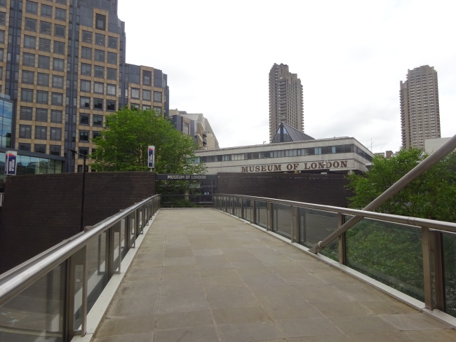
There were also some steps, three flights of about eight steps each, and manageable. This walkway is called the St Alphage walkway and seems to have been first created in the 1960s. Signposting is clear, but not the distances to where you may be travelling to. I was heading for the London Museum, as I knew their toilet facilities were good, and the museum is also excellent from previous visits.
Sadly, it was a Tuesday, and the Museum is currenly only open between Wednesdays and Sundays. Whoops. I did visit it three days later, more to follow on this.
Somehow, I found myself in a large square, with the City of London school for girls, and a large church, and overlooking the Barbican centre where people were enjoying refresments in front of the Barbican. I knew this area after having studied with the OU, it is where my wife and i both enjoyed receiving our degrees and celebrating after; plus many other family degree celebrations later.
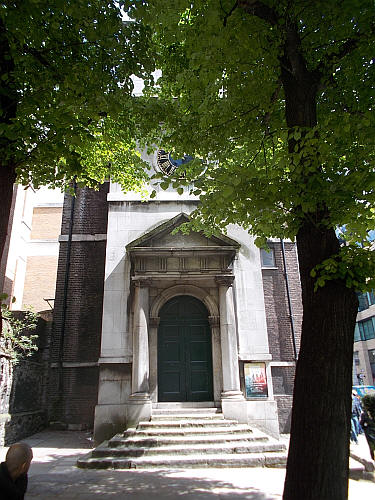
The church was called Cripplegate, St Giles church on the maps, and it was open for visitors. I have to say, i sat in the church quietly, and alone except for an organist playing recital practice for nearly twenty minutes, absolute heaven.
The rest of my day was still significant, but I thought of more interest was a planned trip to the Museum of London for 11.30-11.45 slot on the Friday. The booking is free, and all online, and you have a ticket you can print or store it on your phone. A £5 donation is asked for, but this is optional.
Travelling from the Upminster area, and with the knowledge that there were issues with certain train lines this day, I opted to use buses as part of the travel. The walk earlier on this page mentions Dukes place (at Aldgate), and from here a 100 bus runs past the Museum.
I walked a slightly more direct route from Fenchurch street, via St Mary Axe to reach Dukes place, and the 100 bus follows the route of my walk on the Tuesday, which is quite useful. The bus stops close to the museum, and at least one lift was working to gain access to the walkway above, and the museum entrance.
The staff allowed me early access as they were not massively busy, and I spent over an hour wandering the walk of London from pre-historic times through the Romans and towards modern London. I knew most of this history, but the guides and panels are incredibly well thought out. I did stop for a coffee along the way but there was no service, as I was not aware that the cafe was at the entrance / exit, which was a shame, and I left the museum after about a 90 minute visit.
The bus route back to the trains was more eventful. Firstly the levels of traffic caused the number 100 bus to travel painfully slowly at an almost walking pace; but more importantly you need to know where the bus stops are, and ensure you ask the bus to stop. I left the bus somewhere near to the Tower gateway station, and it took me fifteen minues to walk round to the accessible side of the station in the Minories, and then home. Oh, I decided to get the wrong c2c train back to Upminster, alighted at Barking to swap platforms, which nearly killed me. At least I know now, be warned, this was my own stupid fault.
I rate the Museum of London at least 10 out of 10. TFL gets a 6 out of 10. Barking station gets about 1 out of 10.
Tower Gateway station has an accessible entrance in the Minories only. The DLR route is generally very accessible, most of the time.
Thanks. Very interesting. Love the photos and descriptions. Hopefully places will become more accessible!